OIL & GAS
Philadelphia Refinery Project
Philadelphia, PA
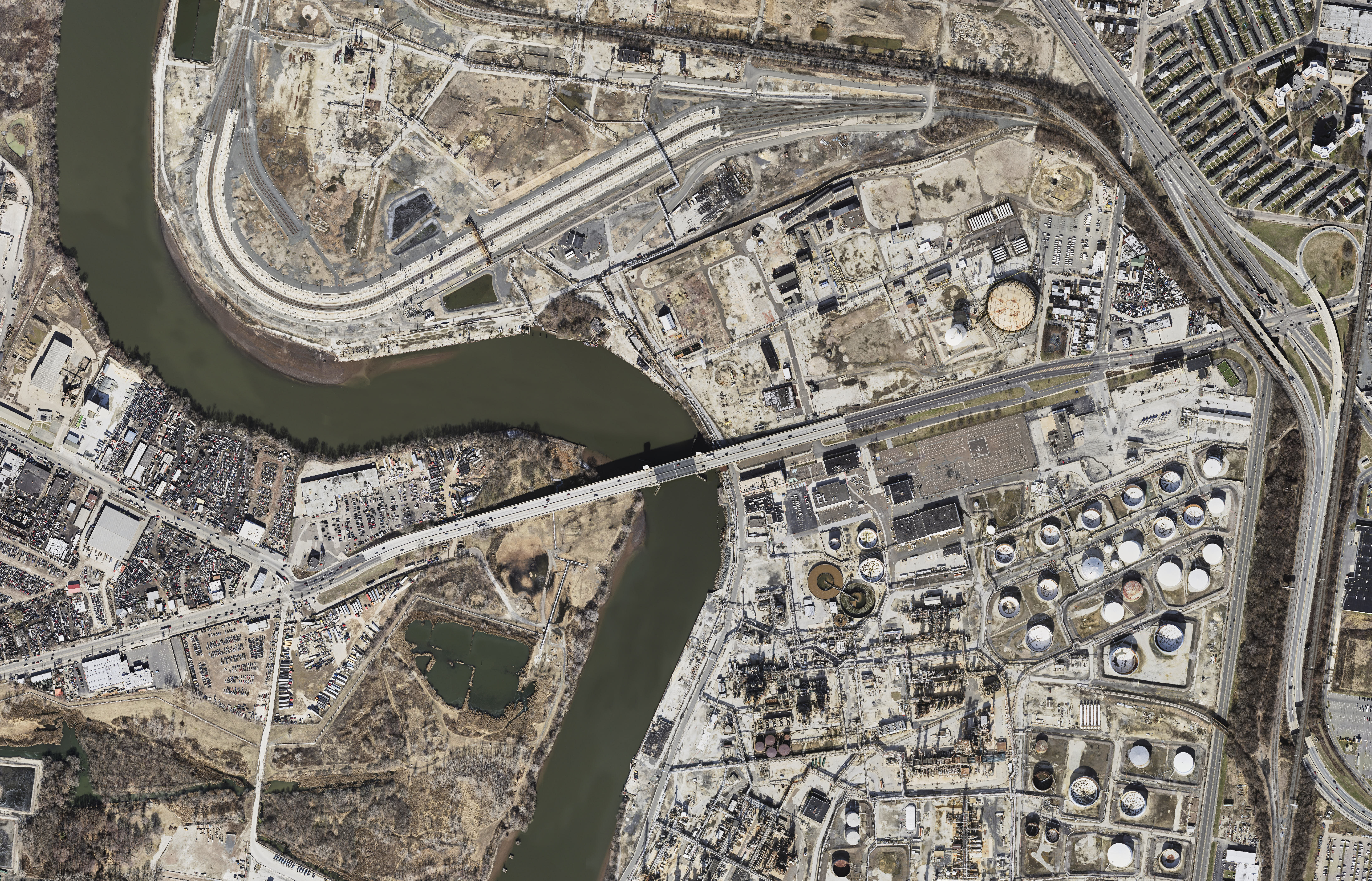
Cooper Aerial mapped approximately 2300 acres for an ALTA survey of the Philadelphia oil refinery site. The project was flown at 3.5cm GSD photography. The mapping was completed for 20 scale planimetrics with 1’ contour intervals of the entire area.
Southwest Gas Parcel and Strip Mapping
Tucson, AZ
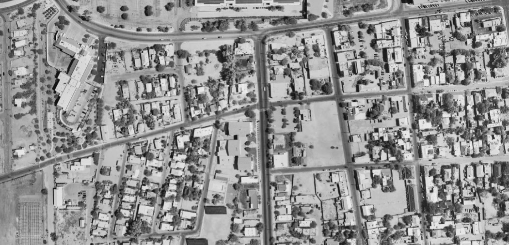
Cooper Aerial was contracted by Ashby Surveying and Drafting to aerial map the Southwest Gas parcel and strip mapping. Cooper Aerial collected 1:3300 color film imagery over the client defined mapping limits. The aerial photography consisted of one flight line with six exposures, with a total of five mapping models. The mapping data was used to compile a 1" = 30" map in stereo to create all planimetric features and 3D DTM for 1' contour generation.
R360 sites On-Call, 14 Oil and Gas Waste Sites, 5 Different States
Texas, New Mexico, Oklahoma, North Dakota, Wyoming
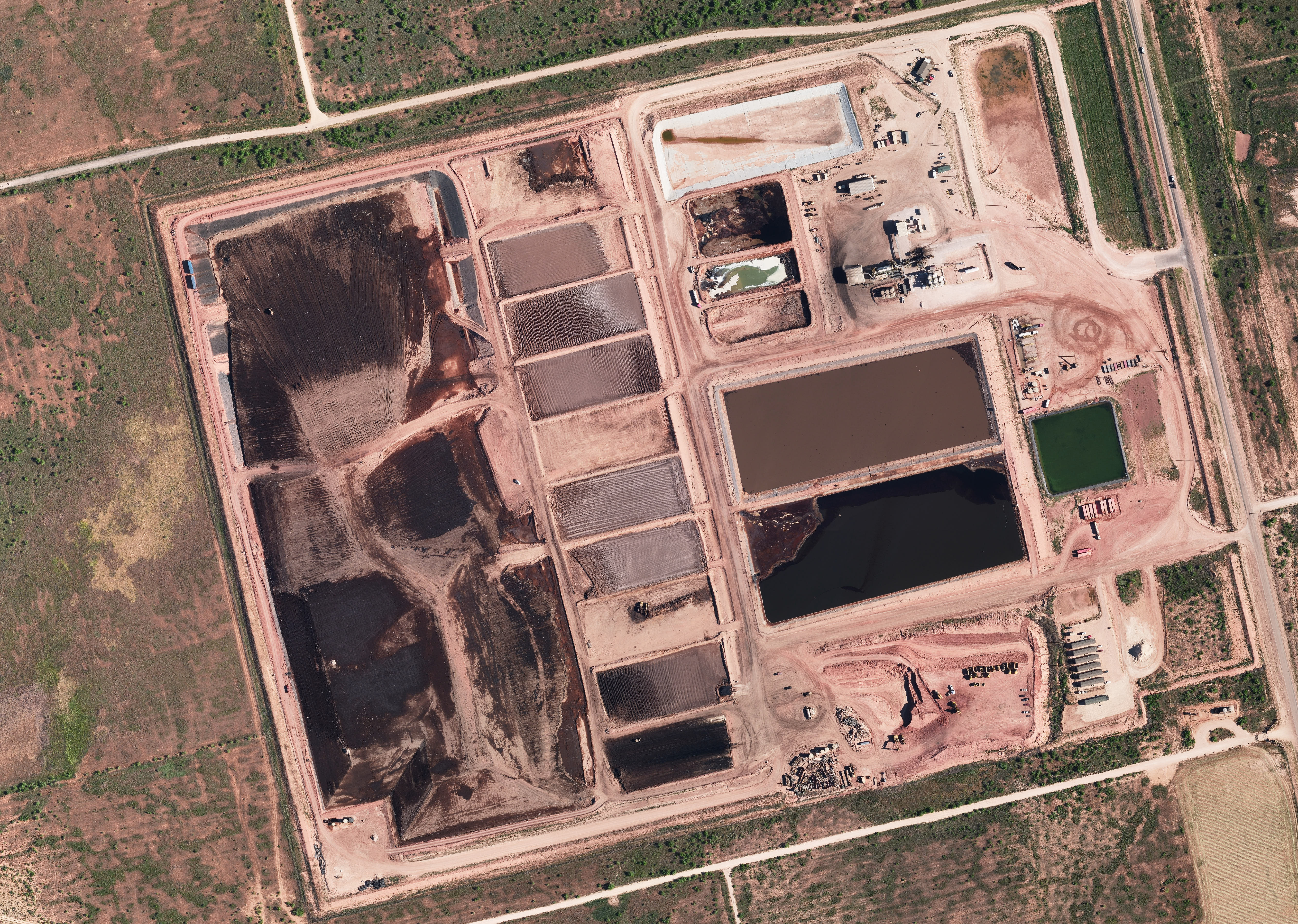
Cooper Aerial was awarded a two year on-call contract to provide 100 scale mapping for 14 gas and oil waste sites across five different states. Cooper acquired 8cm digital imagery using a Vexcel digital camera system to produce a 1”= 100’ scale map to include topo, DTM, planimetrics, an XML surface file, and color ortho imagery.