WASTE MANAGEMENT
Republic Services
National Contract
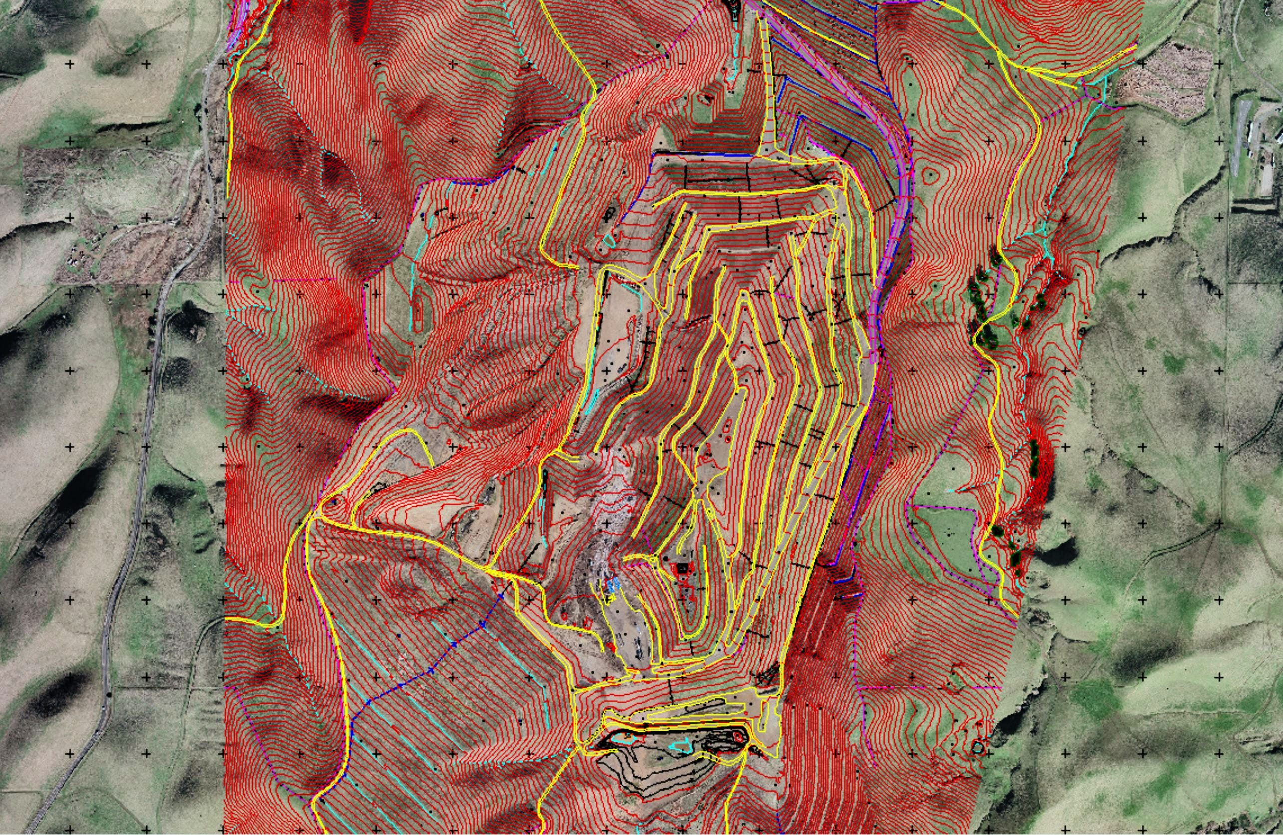
Since 2015, Cooper Aerial has been providing mapping services for all Republic Services landfill sites throughout the United States. Cooper Aerial acquires 1:7200 color stereo photography from each landfill and provides 1” = 100’ contour interval mapping with full planimetrics; a color ortho rectified photograph at a .25-pixel resolution is provided for each site.
GFL Network
Southeastern US
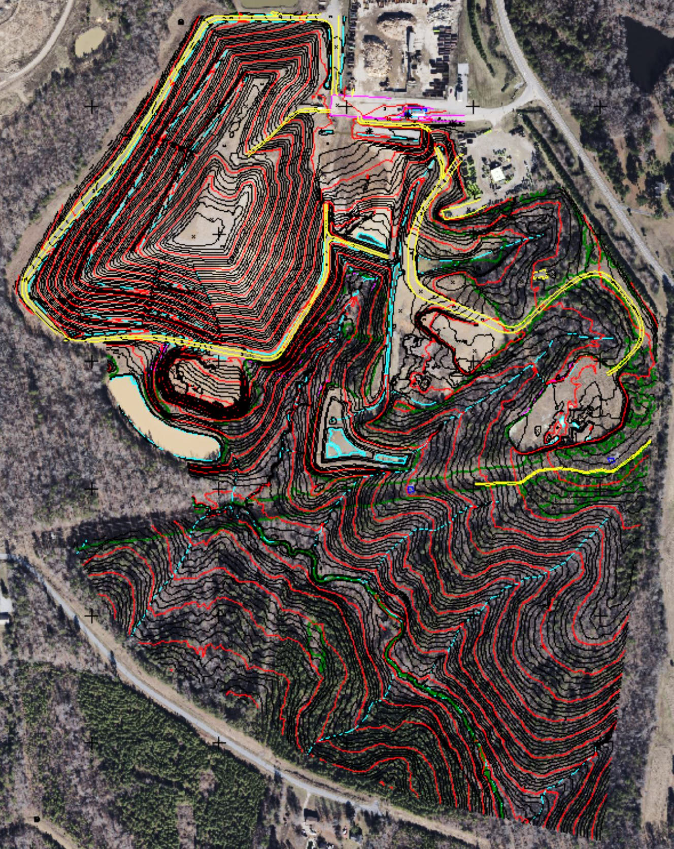
Cooper Aerial was contracted by GFL Inc. to fly and map landfills throughout their network, which included 22 sites mapped for 2’ contours and 100 scale planimetric detail. Imagery was provided at the resolution of 7.2cm GSD. All mapping was completed in Civil 3D and delivered to their engineering department for quantity calculations.
WCA Landfills
Southeastern US
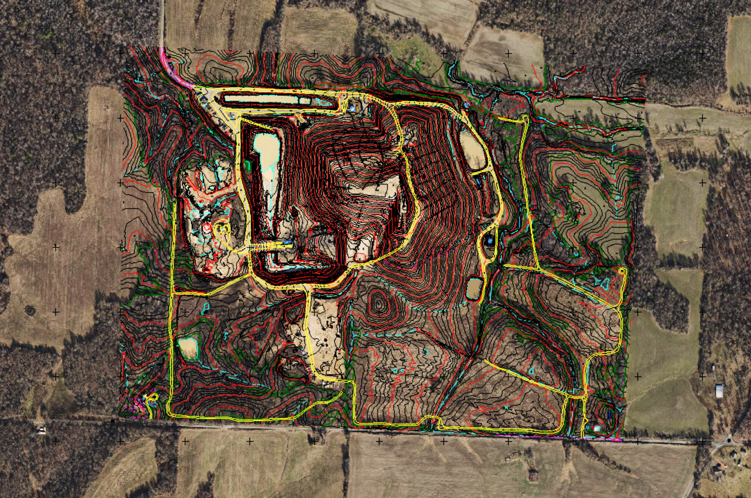
Cooper Aerial was contracted by WCA Landfills to provide topographic mapping for landfills within their network. Cooper Aerial flew and mapped 17 landfills and provided 2’ contours and 100 scale planimetric data for each site. All mapping was completed in Civil 3D and delivered to their engineering department for quantity calculations.